|
|
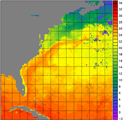
Referring back to the tutorial section about the electromagnetic spectrum, there is a certain band of energy that our eyes can detect, called visible light. Just beyond the red end of that range, at slightly lower energy (longer wavelength) than what our eyes can see, is a section called the infrared. Our bodies can detect some of the more moderate wavelengths of infrared. If you stand next to a wood fire, you feel "heat" radiating from the flames. This is actually the infrared radiation emitted by the burning wood. The NOAA Polar-orbiting Operational Environmental Satellites (POES) carry carefully calibrated, very sensitive instruments that measure infrared radiation. They are basically "feeling" the heat that radiates from the ocean surface, even though they fly about 850km (530 miles) above the ocean! Until January 31, 2016, Coral Reef Watch used data from the Advanced Very High Resolution Radiometer (AVHRR) instrument sensors onboard NOAA's POES to derive its twice-weekly global 50km satellite sea surface temperature (SST) product (discussed in a subsequent tutorial chapter). Each twice-weekly SST measurement was based on data from one AVHRR sensor onboard a single POES. However, as of February 1, 2016, and until the retirement of the 50km products on April 30, 2020, the twice-weekly 50km SST measurement was based on NOAA's operational daily global 5km Geostationary-Polar-orbiting (Geo-Polar) Blended Nighttime-only SST Analysis. (Click here for more details.) If you would like to learn more about the AVHRR "radiometer" sensor and how it measures ocean temperature, see these references:
NOAA's description of the
AVHRR instrument
|
|
||||||||||||||||
|
|
||||||||||||||||||
|
IMPORTANT USER ALERT (2 July 2024): This past weekend, a storage server at NOAA's Center for Satellite Applications and Research, which delivers the NOAA Coral Reef Watch data, suffered a hardware failure. The issue is being addressed, and we hope to have the NOAA Coral Reef Watch data back up and running as soon as possible. (1) The most recent data will be made available first; historical data may take time to be restored. (2) If you need specific data that are not yet available, please contact us at coralreefwatch@noaa.gov. (3) If you use code to pull data, please revise your code to use “…/socd/…” in lieu of “…/sod/…” in all relevant web addresses for all future needs. We apologize for any inconvenience this may cause. |