


(Version 3.1, released August 1, 2018)
(Click here to view these images in a new, enhanced style)
| Current Daily Variables: | SST Trend |
|
|
|
|
|
|
|
|
|
| Year-to-date Maximum: | ----- | |||||
| Year-to-date Minimum: | ----- | ----- | ----- | ----- | ||
| Year-to-date Mean: | ----- | ----- | ----- | ----- |
Click on map above to zoom to small 60 x 40-degree tiles; use drop-down menu below to view larger 60 x 40-degree tiles.
Right-click outside clickable map area to save the image.
|
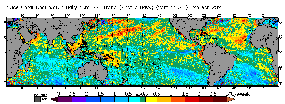
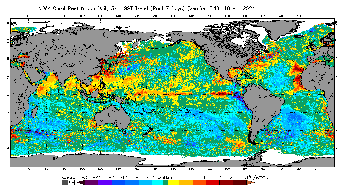
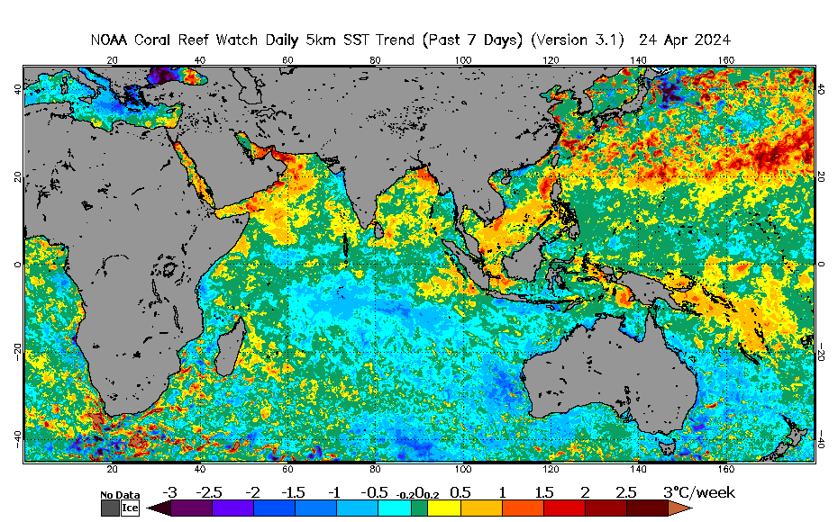
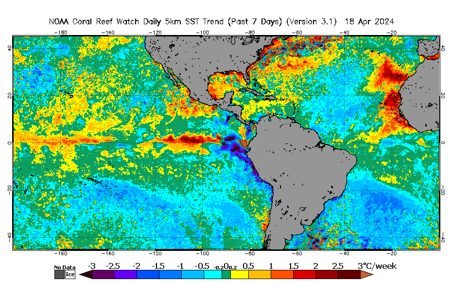
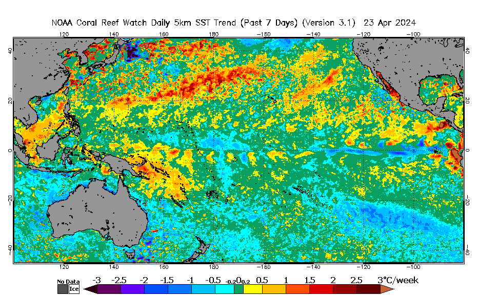
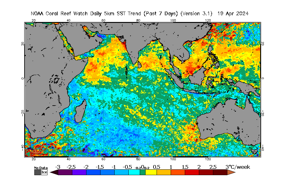
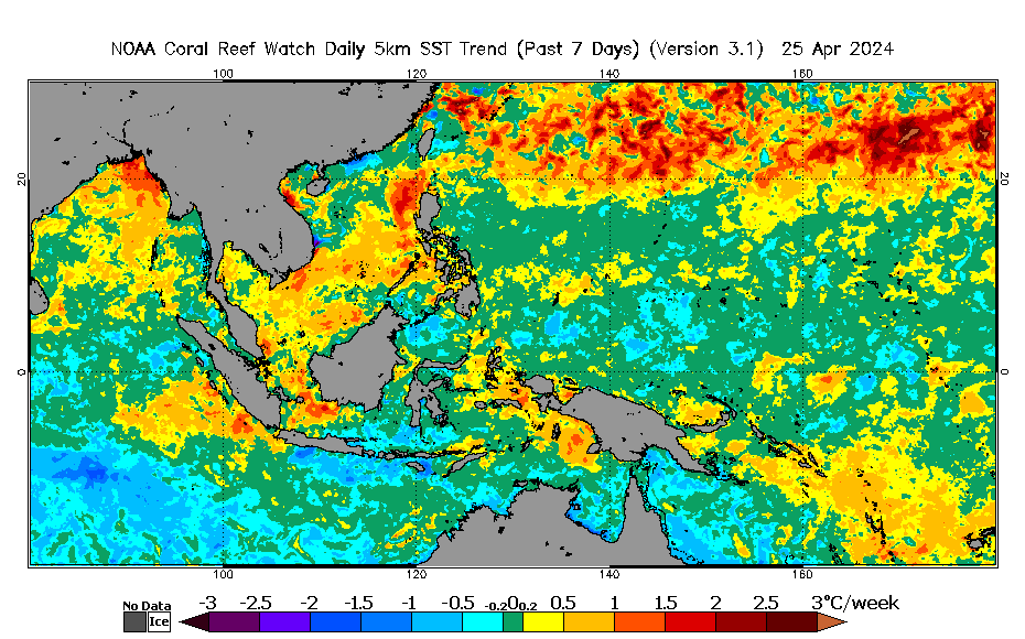
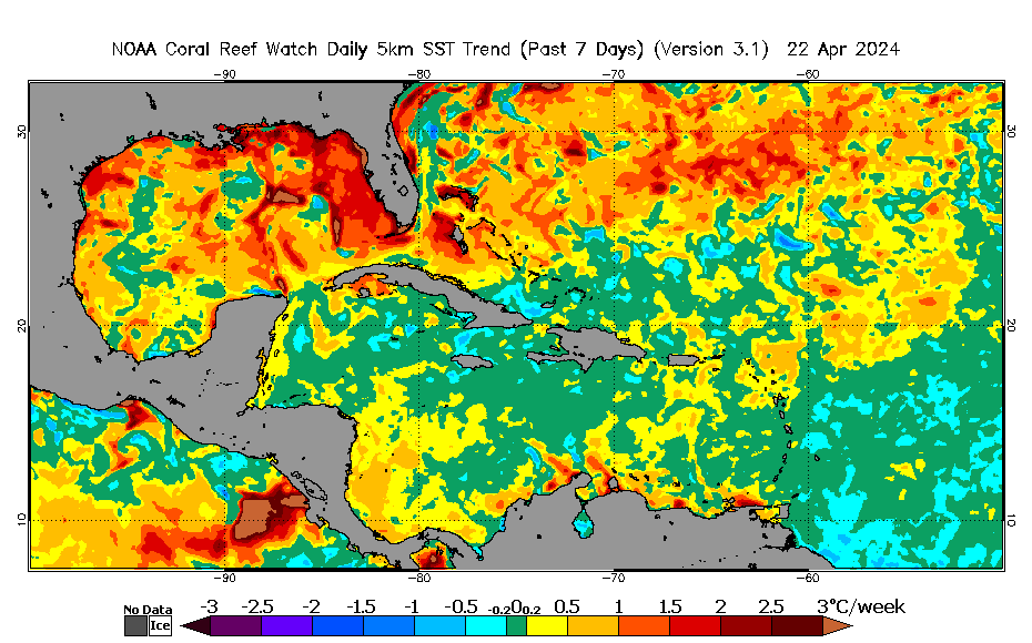
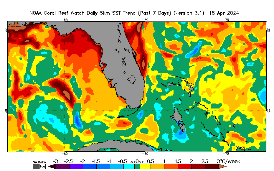
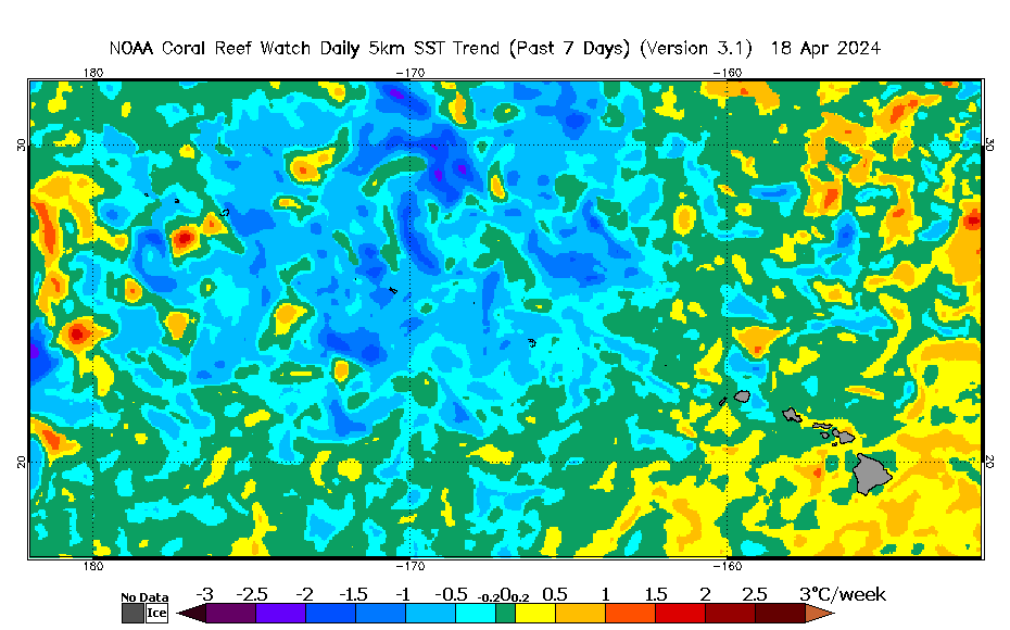
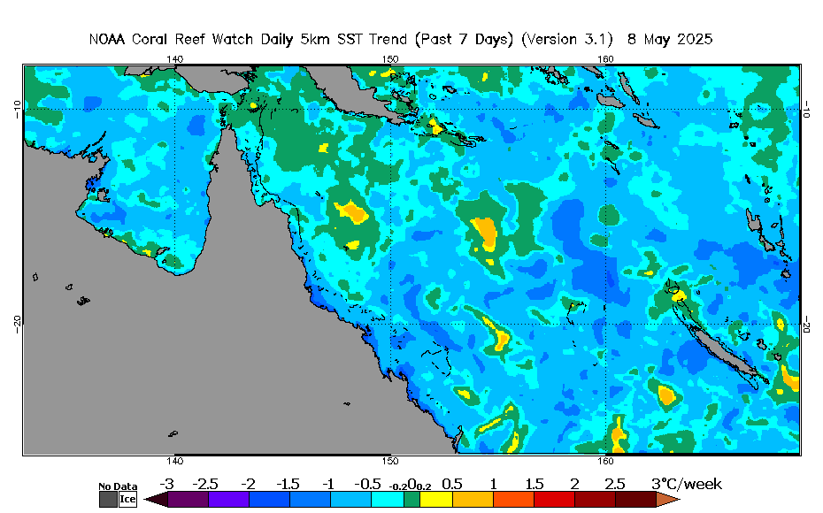
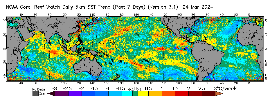
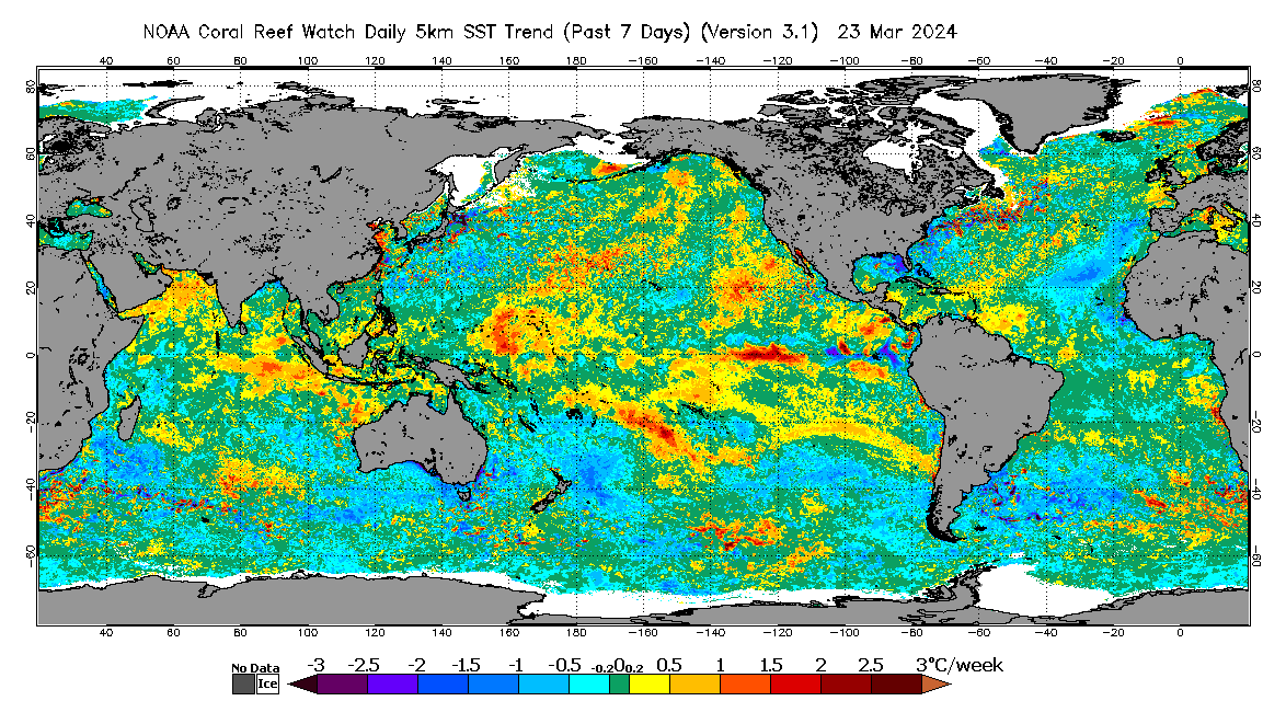
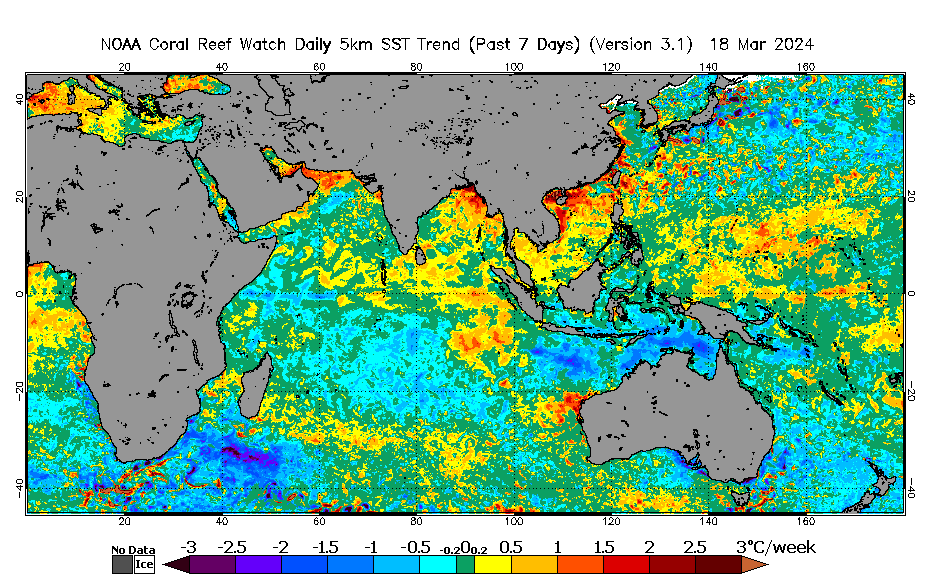
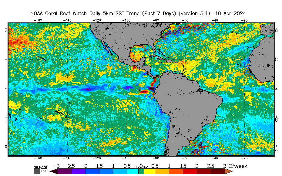
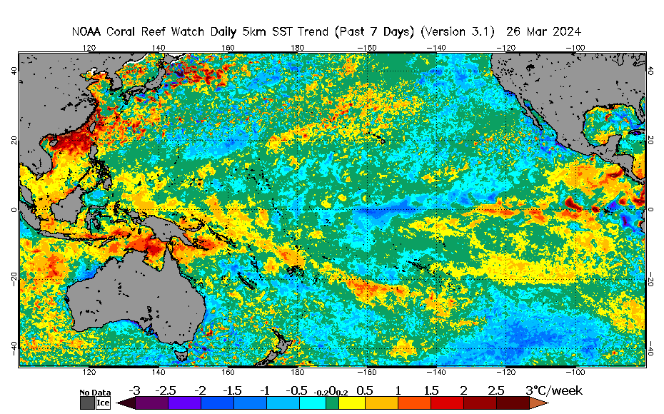
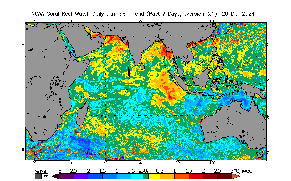
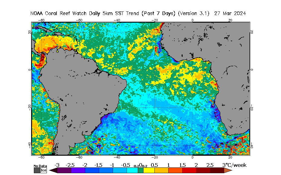
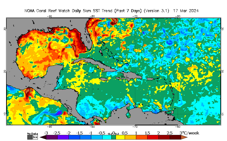
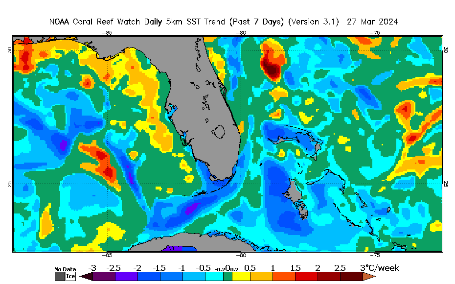
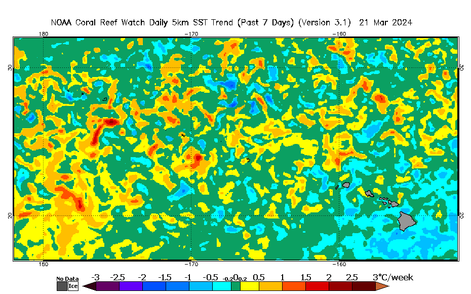
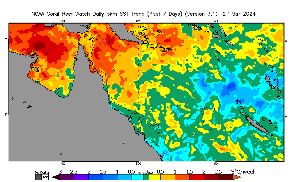
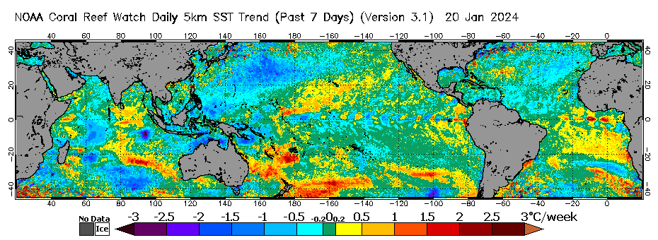
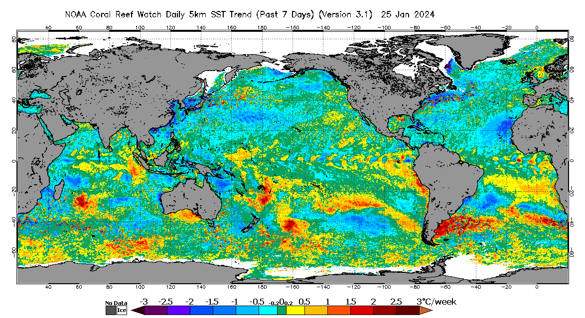
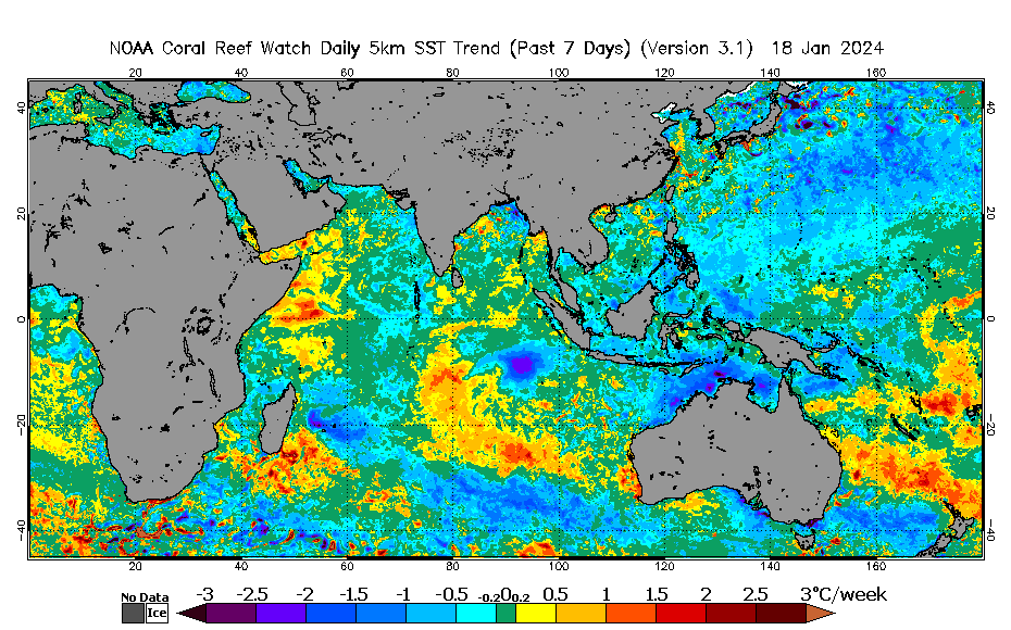
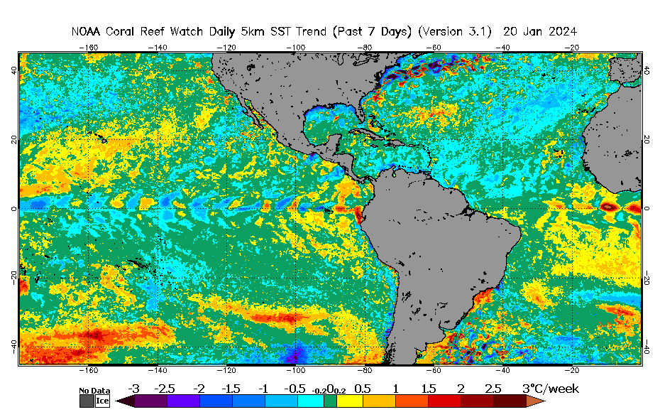
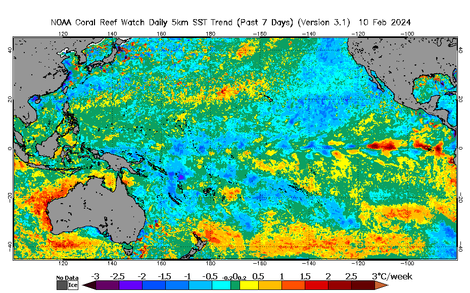
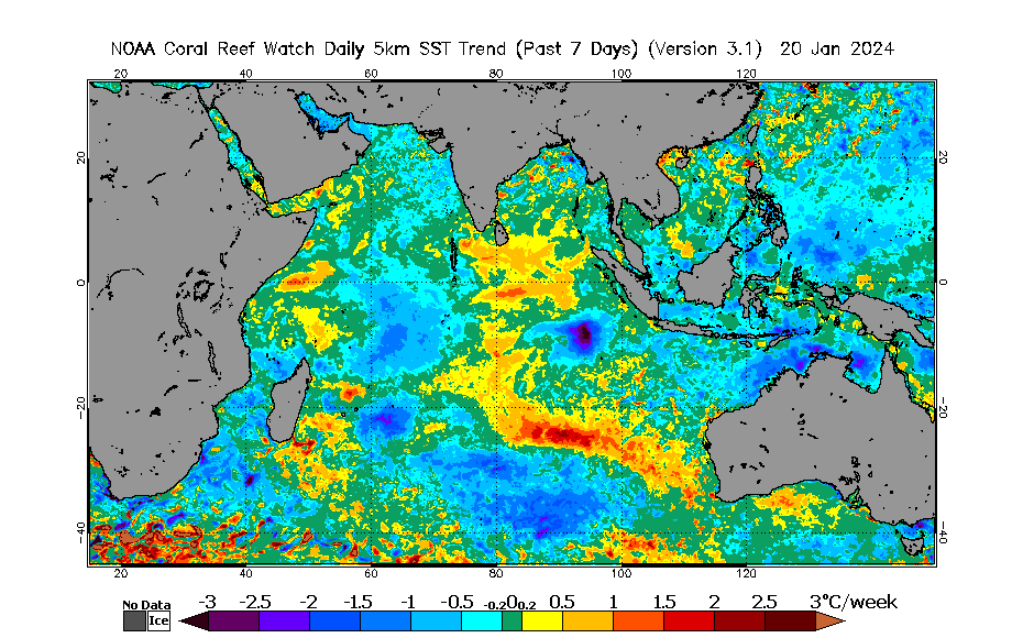
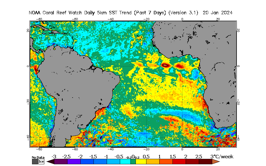
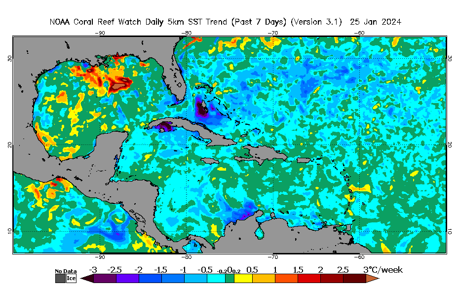
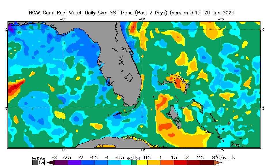
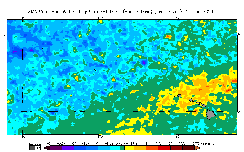
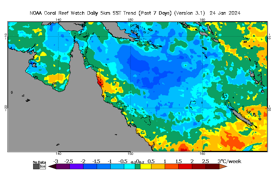
The NOAA Coral Reef Watch (CRW) daily global 5km 7-day Sea Surface Temperature (SST) Trend product, updated daily, provides information on the pace and direction of the SST variation, and thus coral bleaching heat stress, if present, over the past seven days. Seven daily global 5km SST measurements, based on CRW's Version 3.1 daily global 5km 'CoralTemp' SST product, are included in the calculation used to derive the above product images. Pixels colored in green have insignificant trends; this is due either to small SST trends (within the range -0.2 to 0.2 °C) or trends that failed the two-tailed Student's-t test for the 20% significance level with five degrees of freedom. |


![[big]](/data/5km/v3.1/current/daily/gif/cur_coraltemp5km_ssttrend_007d_ctr_2790x1740.gif)
![[big]](/data/5km/v3.1/current/daily/gif/cur_coraltemp5km_ssttrend_007d_crb_2790x1740.gif)